Area clearing and sweeping
Systematic inspection of defined zones for defense and security tasks, with immediate identification of unsearched areas and coverage gaps.
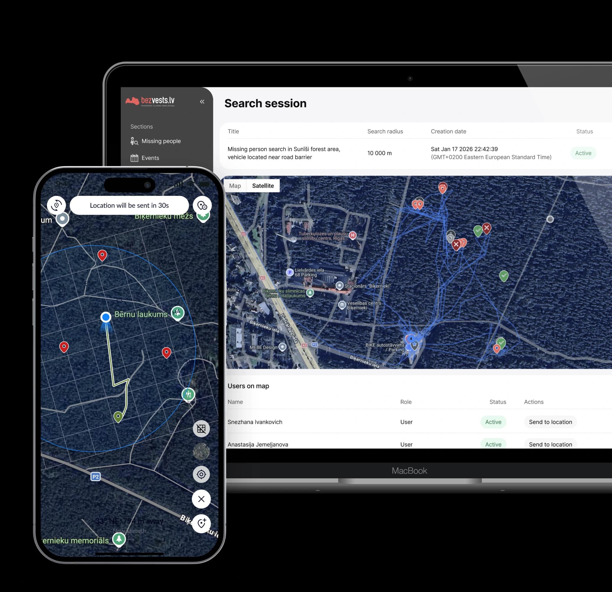
Plan, manage, and execute search missions with real-time visibility across teams and locations.
The system is a centralized coordination and management platform for Search and Rescue (SAR) operations. It provides real-time situational awareness, resource coordination, and verified area coverage across large and dispersed teams.
The platform is designed for both civil emergency response and defense or security operations, supporting coordination, situational awareness, and verified territorial coverage in peacetime as well as under elevated security conditions.
Systematic inspection of defined zones for defense and security tasks, with immediate identification of unsearched areas and coverage gaps.
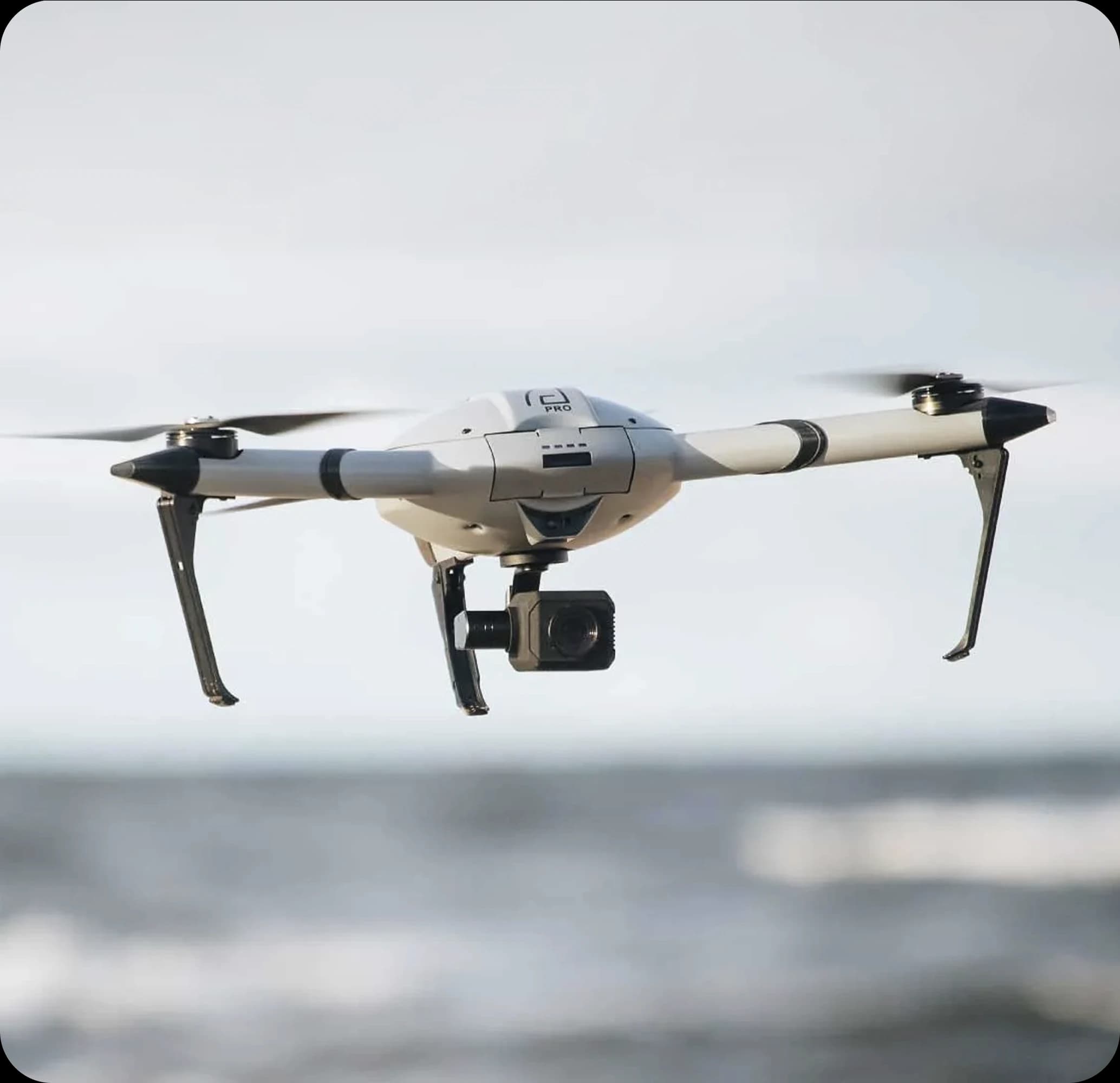
Integration of drone and thermal data with ground operations, supporting both civilian SAR missions and military situational awareness.
Personnel tracking during military or security training, enabling post-exercise review of movement, route accuracy, and safety boundaries.
Route monitoring for infrastructure, facilities, or public events, ensuring continuous coverage without blind spots.
Coordinated civilian and state-led search operations across large and complex terrain, with verified coverage and real-time progress tracking.
The platform is engineered for unstable connectivity, limited infrastructure, and high-stress field operations, so teams can keep working when networks fail and timelines compress.
Core workflows remain usable without continuous network coverage, with automatic synchronization when connectivity returns.
Built for radio silence, disrupted networks, and burst data transmission in constrained environments.
High-performance backend architecture designed for large numbers of simultaneously active personnel and assets.
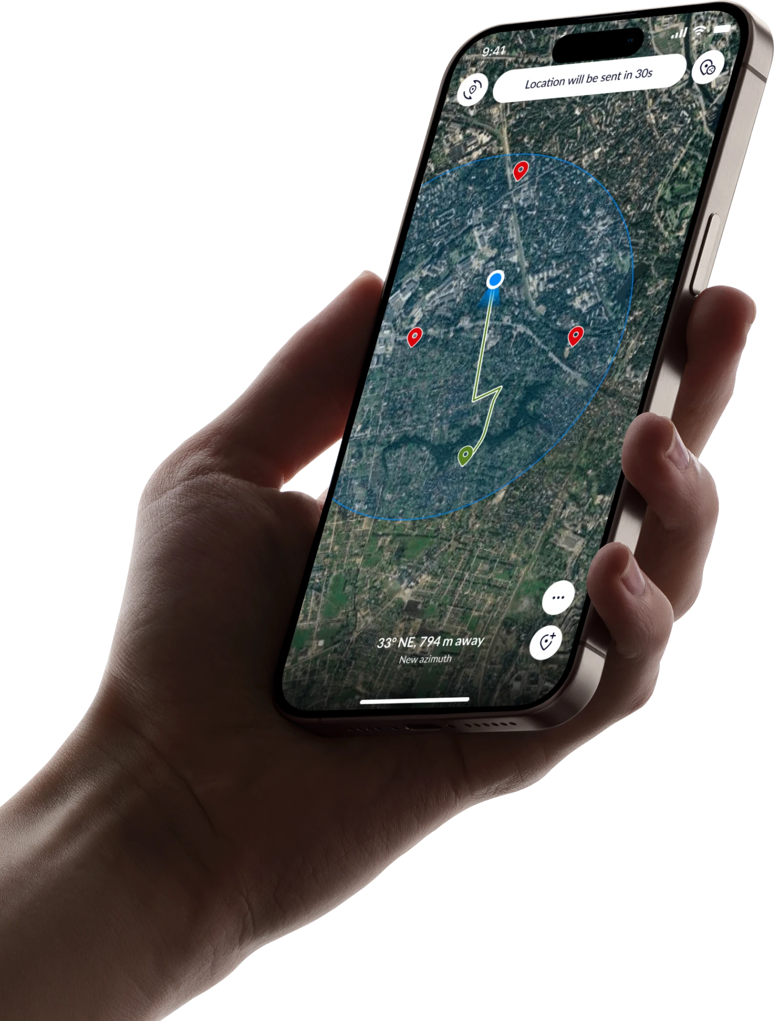
Low-latency position and status updates so commanders maintain an accurate picture of the operation.
Ground units, search and rescue drones, and sensor data are combined into a single operational view, aligning aerial reconnaissance with field actions.
Energy-efficient background processes and adaptive sync to support long missions on battery-powered devices.
The system architecture is designed to meet institutional security standards, ensuring data sovereignty, controlled access, and independence from public cloud infrastructure.
The system operates entirely on internal or field servers, ensuring full control over infrastructure and mission data.
All data is encrypted in transit and at rest to protect sensitive operational information.
The platform does not rely on public cloud services, providing complete data sovereignty.
Permissions and data visibility are strictly segmented by user roles to support secure and controlled operations.

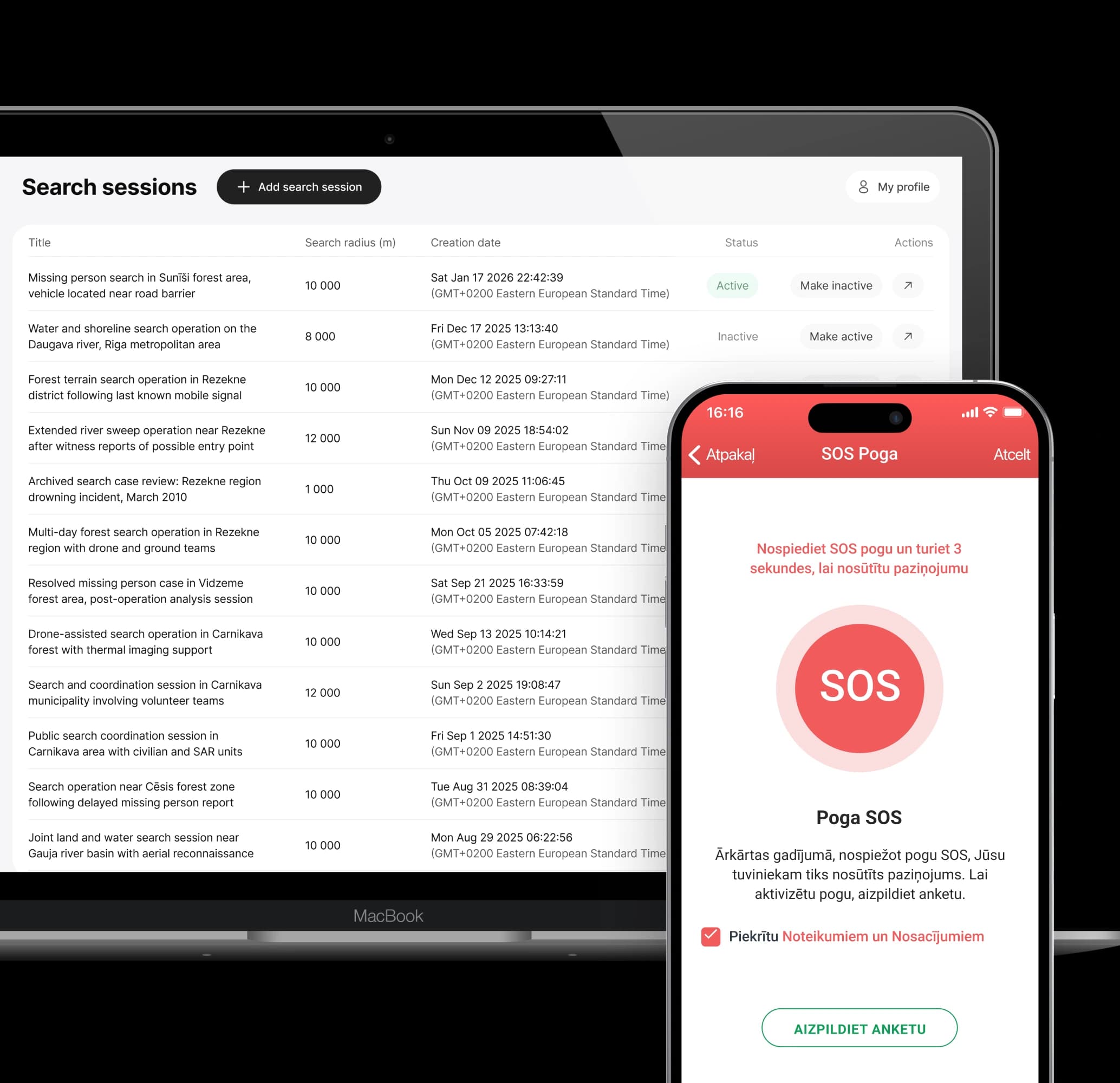
From area definition to mission review — one continuous operational flow.
Command defines the area of operations on the map and splits it into clear, manageable sectors.
Sectors are assigned to units or drones, and tasks are delivered instantly to field devices.
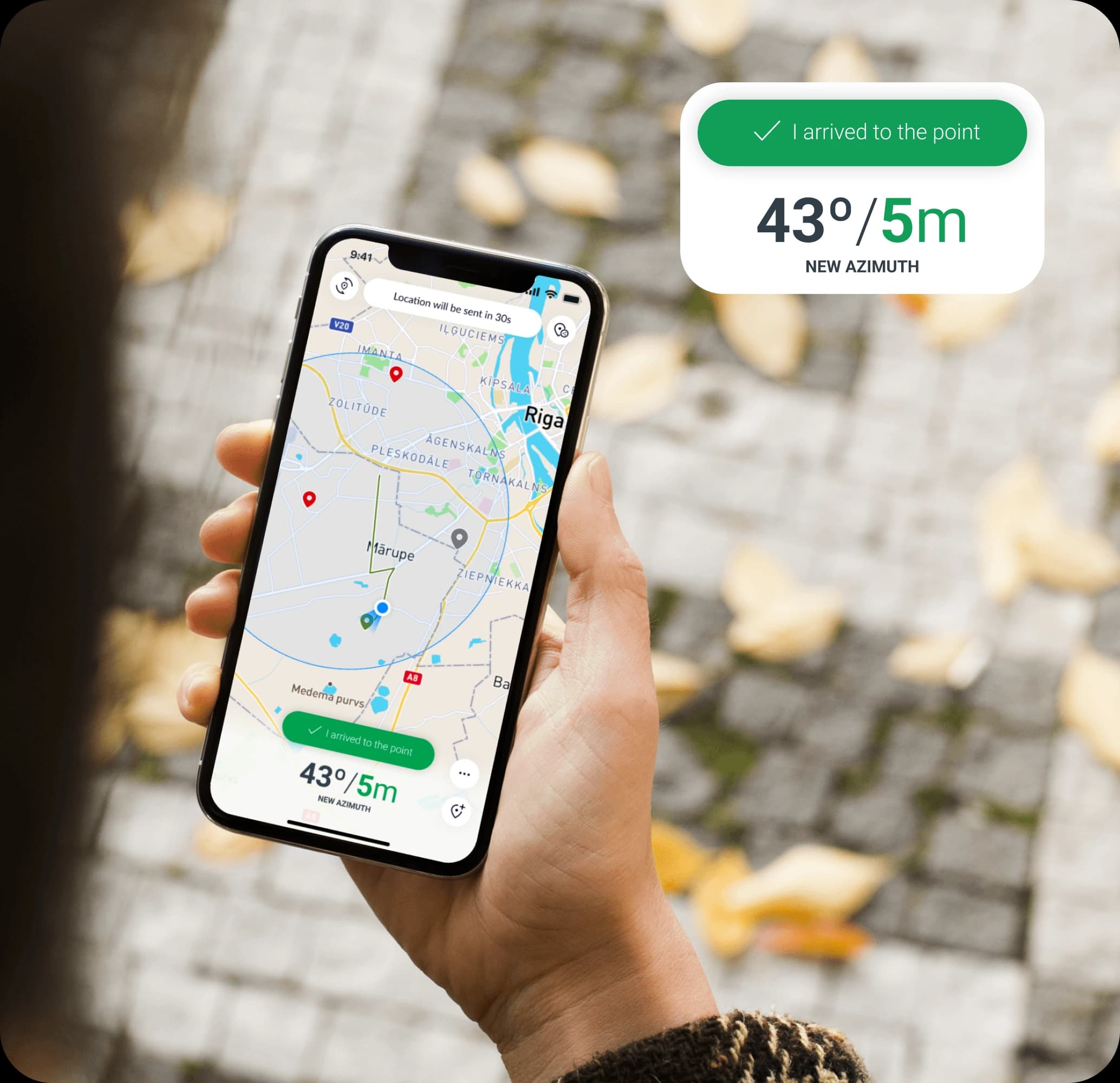
Personnel and drones are tracked automatically, recording routes and coverage even without connectivity.
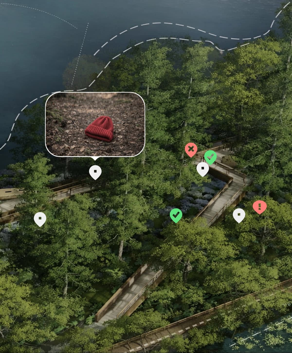
The system continuously identifies unsearched areas (“blind spots”) and visualizes real coverage in real time.
Command corrects movement, redeploys units, and closes gaps based on live operational data.
After the mission, the operation is replayed and summarized with automated coverage and performance reports.
The platform was originally developed in collaboration with the volunteer search organization Bezvests.lv to address coordination challenges experienced during large-scale search operations.
Since its launch, Bezvests.lv has used the platform in every search mission, demonstrating that it is not just a prototype but a practical tool that supports real-life operations.
9K+
participants coordinated
47
real search operations
Read the full collaboration story on Chili Labs' website
From dense forests to limited connectivity environments, the platform's offline capabilities and synchronized mapping have been validated through real-world test missions and operational deployments.
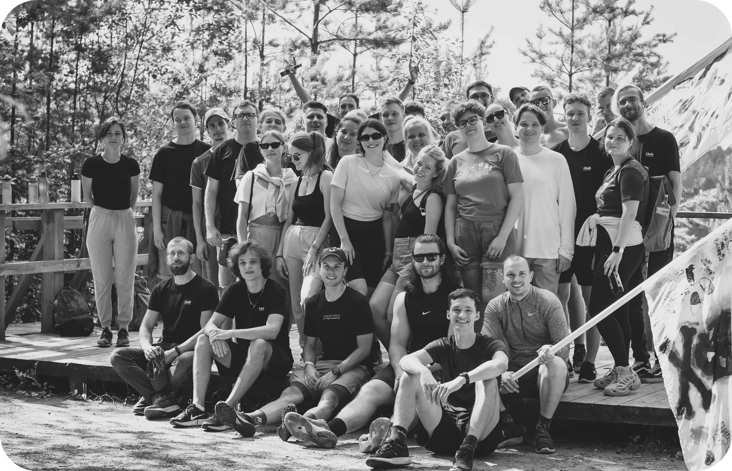
The platform is developed by Chili Labs, a product design and engineering team specializing in complex, mission critical systems.
From the first prototypes to real deployments, the team worked side by side with search and rescue organizations to turn operational challenges into a scalable and reliable coordination platform.
9+years in the industry
100+projects delivered

Learn how the system supports coordination, situational awareness, and verified territorial coverage in both civilian and security operations.


